How to track & trace Narco planes
A visual open-source intelligence (OSINT) investigation and training post on how to track narco planes with open-source intelligence sources (by BH and MB)

“I supply more heroin, methamphetamine, cocaine and marijuana than anybody else in the world. I have a fleet of submarines, airplanes, trucks and boats,” Joaquín Archivaldo Guzmán Loera, more commonly known as El Chapo, told Rolling Stone magazine in 2016.
The drug kingpin wasn’t exaggerating. For a long time, he and his Sinaloa Cartel owned several times more aircraft than Mexico’s biggest airline. According to public records obtained by Mexican newspaper El Universal, until 2016, the country’s military seized 599 aircraft from the criminal organization. Mexico’s biggest airline-owned 127 back then. According to the U.S. government, he owned ‘several Boeing 747s’.
While El Chapo is currently serving a life prison sentence in the US, drug trafficking by air and sea hasn’t stopped, and the sheer number of planes El Chapo owned makes us wonder what had happened to them. Mexican drug lords have made a habit to use private planes to traffic people, cash and drugs across the planet. How many planes do they own is uncertain. Hundreds, law enforcement services estimate. It might be safer to count the crashed or lost ones instead. Suffice to say it’s a healthy number. Most of them are small but they grow bigger, as we will see, increasing the need for longer clandestine/makeshift airstrips.
In this post, we are looking at ways to get you started on interrogating and tracking narco planes and their whereabouts with open-source intelligence tools and techniques.
The Boeing 747 myth
Urban legend has it that drug cartels used one or even several Boeing 747 airplanes. Instead of chasing ghosts, we go straight to the source. Documents from the Chicago District court leaked (originally secret) sustain that “ Guzman owned a personal fleet of Boeing 747 jets, speedboats, submarines, tractor-trailers and freight trains” (source).
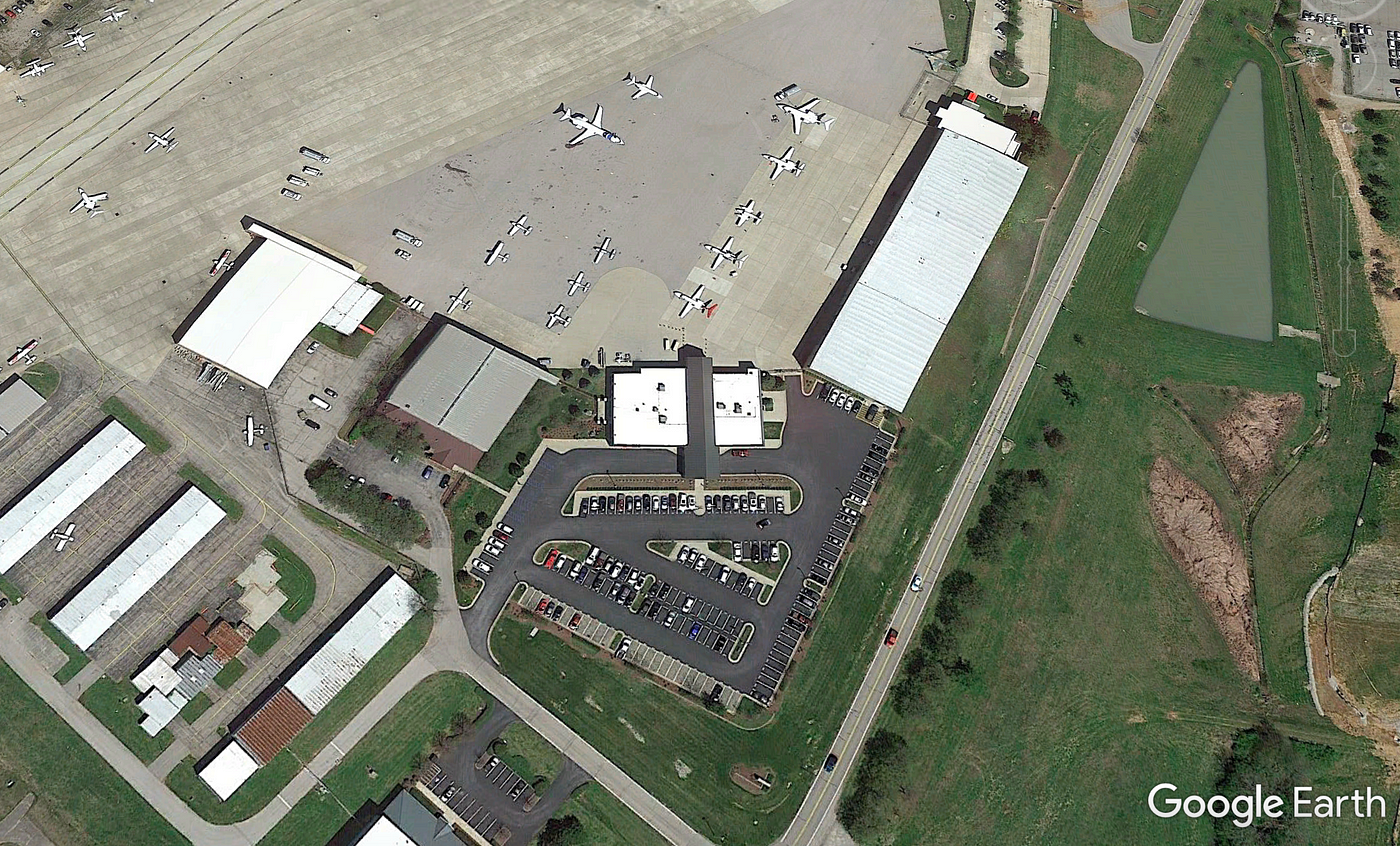
How to fly a 747 around the world without making anyone suspicious? Shell companies and a vast network of unsupervised, private, and often small independent runways, airports, and airstrips across the US help. Private and secondary airports, that grow in numbers and of which there are an estimated 2,500 [are] a massive security blind spot, the Courier-journal writes in October.
El Chapo’s planes: What can we learn from history
Looking at court records can give us a first idea of how El Chapo and the Sinaloa Cartel ran their drug-trafficking operation and help us identify key personnel, as well as possibly connected business entities.
“The defendant earned the nickname ‘El Rapido’ due to the speed with which he delivered the cocaine in the United States. It took the defendant as few as four or five days to transport large shipments of cocaine from Mexico to specific cities in the Southern United States, such as Phoenix and Los Angeles, an unprecedented speed for the narco-trafficking era at the time. As his reputation grew, so did the defendant’s client base and shipment capacity. Before long, the defendant arranged for the nightly receipt of as many as 15 to 20 planes loaded with 1,000 to 1,500 kilograms of cocaine each. These plane shipments to the defendant continued as the charged period began in 1989 and into the early 1990s, when the defendant switched to a maritime method of distribution,” we read in one of those documents.
According to one witness testimony, “The 747s were cargo planes with no seats in the body of the aircraft. Chapo arranged to have a shipment of clothing sent to Central or South America as part of an aid project. Once the planes landed in Central or South America, the clothing was offloaded and up to 13 tons of cocaine was loaded onto the plane for the return trip to Mexico.” From the same witness testimony, we learn that the group set up shell companies in the US.
While this process can be a bit wonky at times (the algorithm didn’t recognize all names and for example, classified “El Chapo” as an artwork), it accelerated the search for names.
We then ran those names through a U.S. database of plane owners and checked for companies using OpenCorporates, unfortunately without any success. After this setback, we focused on local news reports instead.
According to this story from a Detroit newspaper, the U.S. authorities seized a plane bought by the Sinaloa Cartel in 2014. While the plane was never used by El Chapo or the cartel, we can use it to show some basics on how to use plane data. The photo shows the plane’s N-number registration code “N690WT”. From the story, we know that the model is a Rockwell International Commander 690B. Sadly, when cross-checked via FAA Civil Aviation Registry database records, the only entry is registered in 2020 and not yet assigned to a plane.
An increase in narco-plane crashes
The way cartels and drug suppliers traffic drugs come predominantly in two ways: By ship or by plane. Nowhere gets this trend more apparent when big drug smuggling operations are busted or crash. The November bust saw one of the biggest crackdowns on drug trafficking between Brazil and Europe. Next to the 45 arrests of suspects, investigators also seized 37 aircrafts in Brazil. Though, uncertain if some or all of these planes were used to smuggle, it draws an image of what relevance planes play for cartels. Now, with heightened security at land borders due to Covid-19, we may expect that traffickers resort more to air freight strategies, not less.
Narco-crime agents recognize a bourgeoning trend towards more airplane trafficking. The US DEA stated wrote in a 2019 report that “…more and more, traffickers are utilizing private airplanes and secondary airports to augment commercial smuggling”. Traffickers bank on is the idea that private airports are often less stringent in enforcing security protocols and have less law enforcement capacity and personnel.
2020
As flight increased, so did crashes of planes trafficking drugs in recent years — especially 2020 encountered a bloody record. Alone in the second half of 2020, there were at least half a dozen narco-plane were seen destroyed in local or national headlines.
Alone in the first half of 2020, eight major narco planes were counted (including July, as seen in the illustration below). A number of new ones were added in August, October, and November (it remains a bit of a riddle whether crashes are getting merely more noticed as reporting and surveillance improves or if incidents genuinely increased — as in more planes fly and crash).
James Bosworth, founder of Hxagon, a political risk consulting firm and the author of the Latin America Risk Report, a weekly newsletter says that there were a number of narcoplane landings in Cancun and Guatemala last year, “some ended in violent confrontations. I get the sense Honduras has increased recently, though I don’t have good data”.
2020 started with an injured army commander and his driver being killed when a small plane carrying drugs landed on a highway in Quintana Roo, on January 27.
The plane landed on the Chetumal Merida highway in Bacalar. Pilot and passengers opened fire at a military commander and his driver. Bacalar is called hotspot for violence and cartels fight for dominance in the area (well take a closer look at Bacalar and landing strips later).
The incident in January showed Mexican (and US) authorities something new. Though smaller private planes cater well to those who want to avoid detection when flown to small US airfields (private planes tend to fall through the cracks there more easily), Mexican authorities noticed drug cartels increasingly move from small propeller planes to turbine-engine jets.
Armando Ruiz Ayala at the Integral Aerial Surveillance System in Mexico. On January 29, the National Defence Secretariat shared on Twitter images of a plane that carried drugs, presumably for the purpose of trafficking narcotics between Mexico and the US.
The plane’s registration, N18ZL on the side invites for inspection, invites to search on Google for ‘flight tracking N18ZL’ — a quick way to query all the major plane tracking websites at once. PlaneLogger confirms records for a Gulfstream III model and presents its registration history all the way back to 2008, which is apparently still active and ownership is Z-Line Designs Inc. We can see the company owns another two turbine-powered aircrafts, a Learjet 25C and a Dassault Falcon. From here you could dig deeper but we move on as we have bigger fish to fry.
XB-RCM and XB-NRX
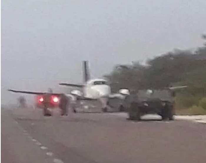
On Sunday, July 5 a plane carrying 400kg of cocaine ‘crashed’. The incident, like many others that are listed on the brilliant Aviation Safety Network website, a most useful reference data source. The plane entered from the south on the highway. Mexican soldiers rushed to the scene, quickly surrounded the plane, which indicates that the state and its military is on high alert.
The second photo shows us more clearly, the registration number is XB-RCM. With that at hand and the accident report, we get the plane’s serial number (257141), its FAA registration ID (N943CE) and can easily locate its profile at some flight tracking websites, such as FlightRadar24 (for which the color in the wings fit nicely to the images above) or FlightAware.
The latter shows a recorded flight from 2016 from the small Texan airport of Horseshoe-Bay-Resort-Airport (a small airport that services private jets) to Toluca, Mexico — where, incidentally, right at the US border, the plane suspiciously turned off its tracker in mid-air.


Back to the July 2020 landing, the location of the landing is about 10 km (or 6.3 miles) from José Maria Morelos (see below, the image with a red circle), Quintana Roo in Mexico on July 5 2020, presumably somewhere on this road (Felipe Carrillo Puerto-Mérida highway, the 184 highway from Chunhuhub to José María Morelos), fitting the video below evidence we have below.


The crew escaped into the nearby jungle. It’s the end of this story but not the end of illegal landings on major roads. We will get into airstrips later but suffice to say, that as the military increasingly clamps down on makeshift airstrips in the jungle, more illegal landings could spread to open roads. The road identified above is unnaturally straight, perfect for a landing of the caliber of a BAe-125. Whether planned or unplanned, its nature offered suitable landing conditions and that’s what we should learn from it to predict future incidents.
The same week of July we heard of another narco airplane incident: that of the Grumman G-1159 Gulfstream IIS. XB-NRX was painted on the burned-out carcass of the jet, discovered on July 2 in Mapastepec, on the very heel of Mexico’s boot — the accident report again is your friend.
The plane was empty when found, totally burned out. It’s possible the traffickers just set it on fire. The practice is common. During its flight, the pilot may have tried to avoid radar detection by flying at ultra-low altitude. Apparently, residents reported a ‘very low overflight of an aircraft, which later disappeared’. Planelogger website doesn't offer much, just that the owner also owns another aircraft, that of XB-NKS. On Spottingmode we can search the list of the Gulfstream II model and find the registered airplane listed under ‘civil use’.


A Facebook post by a news website added more details about how the Gulfstream II ended up where it was found. XB-NRX had its base of operations at the Pachuca airport in Hidalgo. A search on flight tracking websites yields nothing, a sign that the plane chose to disengage its tracking signal leaving us mostly guessing of the pilot’s intentions.


Moving on: For a narco plane crash in September, aviation officials say a business jet was reported stolen in Mexico and made a stop in Venezuela before crashing and catching fire in Guatemala. “Drugs and some weapons were found at the crash site”. We got no registration and all we know is that it is presumed that the plane carried illicit stuff, CADAI (the Comprehensive Aerospace Defense Command) said on Twitter. The model: a British Aerospace BAe-125 plane, a turbine engine plane.

September, 23, featured another narco plane crash, again a British Aerospace BAe-125–800A. From the image below we can only make out the last three letters (PYZ) from the tail sign. How do we get the rest? It’s OSINT 101 is your friend: by applying a ‘partial’ or ‘wildcard search’ we get the rest (left below). With that info we learn that the army found the plane and released intel that it took off from the Mariano Matamoros airport in Cuernavaca, Morelos, in Mexico without authorization or flight plan to the Zulia state airport Venezuela.


The video by FSX Aviation (an account that posts lots of plane crashes) and first posted by Twitter account @RBCNoticiasGT, is intriguing. More than eight heavily armed military men surround the debris at the location in Alta Verapaz in Guatemala. One package features a swastika sign (how odd). A rucksack with a logo and a set of small arms and equipment from the plane is laid out onto the ground for inspection (posted on Twitter by reporter JuanVictorC at #RadioSonora).


A quick image reverse image gun check on Yandex for the handgun image suggests the upper one appears to be a Glock model (we are no gun experts and it’s harder to tell whether the lower model is really of the same type, it seems so but perhaps one but with an added component attached to the gun body. The Austrian-made Glock model 17 is used by the Armada de México and the Venezuelan Armed Forces). We can also see some documents, which, if we had more high res images, could reveal some insight of their nature.


Reports stated that only months earlier two other narco-trafficking operations used the vicinity of the Mexican state of Quintana Roo to land their planes. National observers worry about the economic impact and reputational loss. Quintana Roo is a major tourism destination. The two cartels most dominant in the little state is the Gulf Cartel and the Los Zetas. One of the founders and early chieftains at the Gulf Cartel was certainly no stranger to narco air trafficking. García Ábrego, witnesses said, smuggled Colombian cocaine on planes and then hidden it in border cities along with the Mexico–United States border before being smuggled to the Rio Grande Valley.
Today, the Mexican military is on high alert. In early October, Mexico saw two narco plane crashes. On Oct 5 in the morning Integrated Air Surveillance System registered an irregular flight in the Quintana Roo (more exact location: Sergio Butrón Casas). A BAe-125, again. Similar pattern as before: The plane touches down on an illegal airstrip close to the border with Belize. The occupants set fire to the plane. The incident concludess a streak of seven aircraft crashed/insured in the South of Quintana Roo, all related to drug trafficking.
Another one in October featuring a crash in a remote area of Queretaro. A smaller plane rammed its nose into the ground after being chased by Mexican military aircraft, reports say. As the plane was carrying so much cocaine, the authorities didn’t even let the owner of the airfield access the property. Instead of shooting at the plane, the military might have just chased it until it ran out of fuel and crashed. Without finding an adequate landing area the crew was left to its own devices. If confirmed, it’s rather cruel.
On October 4, in Machiques, Zulia, Venezuela, near the Colombian border, a Gulfstream III airplane landed on an illegal airstrip and used for illicit goods shortly before being burned to the ground by law enforcement services. It’s owned by ‘AIRCRAFT HOLDING SOLUTIONS LLC TRUSTEE NEWARK , DE, US’, according to FlightAware records. Only months earlier in August, it might have changed hands, records indicate. Again, we are not alleging that the firm listed here and located in NEWARK DE did anything illegal but it opens avenues to question and dig deeper.
On RadarBox, the plane is on a ‘blocked aircraft list.’ Though few reports emerged, a YouTube video shows the burning airplane (below). Only in June another plane landed in the same area (in the Machiques de Perijá municipality) and tragically injured a Mexican citizen.


In mid-November, a Grumman G-1159 Gulfstream on its way from Venezuela crashed. The plane suspected of transferring narcotics with the registration of ‘N104VV’ was found next to several drums of jet fuel (so obviously didn't run out of it). Its owner changed in July. Its FAA record entry shows it only received a temporary certificate in July which was due to expire a month later on 08/20/2020. Its owner at the time is recorded as ‘AVIATION TRUST COMPANY LLC TRUSTEE’.
One website that seems to fit the description (based in Oklahoma) which offers a service to clients to ‘helps entities and individuals register their aircraft on the U.S. registry, by meeting FAA requirements’. Theoretically, that’s something drug traffickers would want.
Again, we can not allege involvement. But again it opens some avenues for questions. Noteworthy is that the find of the plane led to the dismantling of the clandestine airstrip the plane was found on. The location was in the Río Bravo sector of the Catatumbo municipality. We couldn't locate the crash site on up-to-date satellite images which doesn't mean it isn't there (reach out if you find it!).


Suspicious airplanes are a fairly regular occurrence in Mexico, where cartels often use small planes to transport drugs north, from South America to their eventual destinations in the United States. The air force has an aerial vigilance system, a network of radar and sophisticated aerial tracking software to track suspicious flights in Mexican airspace even before they enter.
For the Peru-Bolivia air bridge, crashes grew more frequent. After hundreds of flights and a new drug boom — particularly noticeable in Peru’s Apurimac and Ene River Valley — the number of crashes and accidents spiraled.
PNG — Papua New Guinea
New location, similar game. This time on the other side of the world. Members of a Melbourne-based criminal syndicate, with links to an Italian organized crime ring, have been charged for conspiring to import over 500 kilograms of cocaine from PNG into Australia.
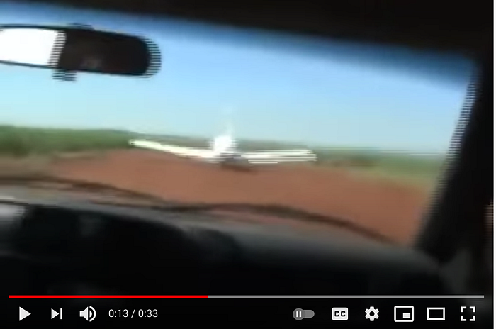
The crash was reported in early August (here by the Guardian, Aug 1). A plane with the registration number of VH-TSI started off in Australia and switched off its tracker. It flew at low altitude in an attempt to evade radar detection, so the reports say. On its way back, when trying to take off, it crashed near Port Moresby. It tried to take off at an illegal airfield outside of Port Moresby with its crash site in Lea Lea (30 km northwest of Port Moresby) and near an LNG processing plant (this plant). The crash records on Aviation-Safety confirm the makeshift runway in Papa Lea Lea (see image, left).


Open records show that the 1981 CESSNA is registered to the owner under the name of RAVENPOL NO. 69 LIMITED PORT MORESBY , N.C.D, Papua New Guinea. That’s useful as the blue tail sign showing West Australia-based Goldfield Air Service isn't the owner. We also get a few more details from the Australian Civil Aviation Safety Authority (short CASA), which warrants keeping in mind for subsequent investigations.
On Planefinder.net, we find past records when the small plane was last active. It matches our records. The traffickers disabled their flight tracking in mid-air. We know they tried to avoid detection by flying low, below 1,000 meters (3,200f), a pattern we should take note of.


FlightRadar24 (if you sign up for a free trial) offers you two different KML files which we can fire up on Google Earth Pro. There we can see where the plane turned off its tracking device at 2,700 ft at 32:26:51 UTC:
Now, with a lack of other information, it often helps to look at analysis by others. Investigative journalists at PNGicentral did a great job in picking apart the case of VH-TSI and found a few other things we’d like to list and appreciate. One database that they consulted is called the Investment Promotion Authority, which revealed that Ravenpol №69 is itself owned by Geoffrey Paul Bull, who was claimed to have died after an attack that involved the mafia in POM.


Who owns these planes? PNGicentral’s investigation shows us a good example of how to quickly drill down into individual ownership structures. From CASA records it finds the operator (Avlease Pty Ltd). Then uses the Australian Securities and Investments Commission to confirm the co-owning companies (one is called V M Carter Pty Ltd) and then ascertains the owner of that company (Vincent Mark Carter). As we do in this post, they then make sure not to allege responsibility or awareness of any illicit activities. All good OSINT practices (until you have final evidence, allowing you to raise more specific claims). Listen to this:
Quote from PNGicentral investigation: Beyond the CASA record, there is no evidence to suggest Avlease or its owners were in any way involved in the final flight of VH-TSI. Indeed, Ian Scheyer has told ABC Radio, “hand on my heart” Avlease has never operated the aircraft and he cannot explain how his company came to be listed on the CASA register.
Moving on: Owners and registration numbers
Alleging ownership is often tricky. Owners can change. Registration numbers can change. Assets can shift quickly. But sometimes you are lucky and the link between the company and narco aircraft is in plain sight.
In the case of a Gulfstream Aerospace G-1159A Gulfstream III with the registration of N450BD, the owner can be more easily linked to the plane that crashed in El Chal Petén Department, Guatemala on July 26. FlightAware records show the plane to have turned on its tracker, though only for 31 minutes between Cerro Santiago (radar Guatemala) and Dixon Hill (radar Honduras). The plane, as we have seen in the other examples, only had a short while before retirement (note as a typical pattern).
Its expiration date was scheduled for October 2021. FAA records reveal the owner of the plane: registered as 477 AVIATION LLC, the company is based in Beverly Hills, California. We check the firm’s records and how it advertises itself online and we find data on a website called Prijet which reveals the connection between N450BD and the company from California.
We even find a pilot (Chief Pilot at 477 Aviation LLC) on Linkedin who may or may not still work at the company and may know more about what happened to the plane before it fell into the hands of narcotics traffickers (though, again we don't know and certainly don't allege anything in this regard).
Apart from the question ‘who owns 477 Aviation?”, which appears to be Gerard Guez a fashion mogul (thx to the comment by @just_some_d00d on Twitter), from here on we can only conjecture.
OpenCorporates lists the company’s agent name as ‘CHRISTIAN TRUNNELL’ with the registered address of 801 S. FIGUEROA ST. SUITE 2500 LOS ANGELES CA 90017. Again, the quick warning here to dismiss any potential libel claims, we do not allege any responsibility or involvement here. We simply present data from open records.

It’s astonishing what we can learn from open data and fellow social media users (this Reddit thread features a number of interesting comments). The landed about 14 km from El Chal, social media account of Oscar Pereza claims, in a field and was set on fire before being abandoned. The Guatemalan Army found a large pile of bags filled with narcotics in a hole near to where the aircraft landed. We couldn't find the crash site on Planet Lab images but we tried.


Are there patterns traffickers follow?
Typical patterns traffickers follow is to fly at low altitude and abandon their plane after landing. Crashing usually means detection and when an accident happens the crew often takes off into the jungle with what they can carry. Often, whoever flies the plane happens to be a freelancer, Narco News writes.
Other sources claim that often pilots of these planes are being generously compensated, 50,000$ source for the WP story claims. That’s because crashes occur so frequently. One plane crashed into a getaway vehicle parked next to the clandestine airstrip.
How easy is it to purchase a plane that could be used for drug trafficking?
In 2018, a local Miami news outlet reported on the increasing appetite of traffickers to buy planes in the US. Drug traffickers purchased a Cessna to transport loot and equipment between appointments. Some of the traffickers were killed after landing on a tiny Honduran airstrip in a village called Las Marías.
True, planes found generally suit a budget buyer, crashed planes are mostly smaller planes. In the US and elsewhere, such planes can be purchased at public trading sites. One of such sites is Trade-a-Plane. One of the patterns we saw is that often planes become narco-planes at the end of their lifetime. That’s when the planes are the cheapest and most disposable, making it less costly to leave the plane on a run-way.
Many of the smaller planes include old Cessna models. In general, these are commonly available types which are now around 30–40 years old, H I Sutton writes in his excellent OSINT blog in July (worth checking out).
Such planes usually cost less than $100,000. A few of them (at the time of writing) are sold for around 15,000. One is a Cessna 150F with around 4,586 TT is on the market for £15,000 (see image )— a photo shows its registration id, which we can check on FAA records. The plane type can fly long enough to bring drug cargo across country borders.
Often planes appear to be bought second hand on the cheap in shady deals and then used a couple of times until they get caught.
Which jets are most popular for larger trafficking operations in South America? Some think that it’s the HS-125 (British Aerospace 125), a plane type a bit more common than the Gulfstream model. They may be flown from Venezuela or Colombia, north to Belize, Guatemala or Southern Mexico, and there is still a vibrant second-hand market for the type in the US. Below you see a typical private offer for such a type of plane on Trade-a-plane.
In the case of successful drug delivery, traffickers know that the profit from it easily offsets the cost of such a 30-year-old plane. One of the best examples is when in late October the Mexican military ceased a similar plane that carried $72m worth in cocaine (a similar shipment, this time drugs worth $141m, was confiscated only a month earlier). No one knows where the plane departed from.
What does it take to buy a plane? Not much, especially smaller ultralight aircraft are easy to get. They used to be very popular. Hard to detect via radar, quiet to avoid attracting attention and easily blending into the background when flown over the US-Mexican border, they seem ideal for it. One report from a few years ago claims that these ultralight aircraft offer a relatively cheap and fast alternative to traffic up to 250-pound drug loads over the border with little risk of detection by US Border Patrol.
For trafficking large amounts from South America, such smaller models are not useful. But, it turns out, it’s relatively easy to buy even the larger types. At least in the US, that is. One employee at Eagle Support Corporatio, a Miami based company, sold a plane a few years ago that then went to a Venezuelan firm. In a newspaper interview from 2018, the source explains why buying and selling planes is so simple. Listen to this:
Even under American law, “to buy an aircraft doesn’t require a lot of screening,” Carlos Vasquez, an Eagle employee say. “It’s really hard for us to spot who is who,” he says, adding the traffickers “build shell companies” or use intermediaries to create an air of legitimacy. Lawyers, escrow accounts, and corporate anonymity make it difficult for brokers to know exactly who their customers are (quote from Miami New Times article, 2018)
An employee of another company, Skyline Enterprises, said that once a plane goes to a buyer overseas “you could turn around and give it to your cousin… It’s kind of hard to track.” (None of these companies were held accountable for any wrongdoing).
In short, even if you find the owner of a plane that classified as a narco-trafficking vehicle, an intentionally opaque network of shell companies and oblivious aviation firms that sell the planes and who might claim to have ‘no idea they’re aiding drug traffickers’, make it all hard to catch are responsible. Authorities lack the power to stop the deals from commencing. And that’s where the regulators must come in. Planes should not be able to be sold when the destination of the user isn't clear or questionable.
Routes
One often-referenced route these smaller planes take is from western Venezuela up over the Caribbean to Central America (H I Sutton). We will take a look at small clandestine air trips in those and other parts of the continent.
If we can find the places where these crashed narco-planes were discovered, we can define patterns for conditions — e.g. on what surfaces and locations traffickers tend to land or what behavior planes tend to display. One pattern we noticed is that traffickers often, just before leaving, torch their plane. They manage that often shortly before the police arrive. In one instance in 2011, a police car crashed into a wing with their car to stop traffickers to take off.
Last year, a plane was found in the Barinas state, in Venezuela. Some sources online pointed at corruption and how it may play a role in narco planes crashes. If plane operators don't pay up, the Venezuelan government might intervene. SOUTHCOM, a consultancy, thinks that corruption plays a major part and that Venezuelan forces do frequently destroy narco planes because these didn't pay ‘the tax’.
Clandestine landings: A study of airstrips
DIY/makeshift clandestine airstrips help drug traffickers to move drugs in and out of location across South America swiftly and efficiently. They are essentially the cornerstone of narco air freight and pillar to the value chain from the ground up. Reason enough to study them more closely.
There could be thousands of them that drug traffickers use to get to and fro hot spots of drug production. One report put the number of clandestine airstrips used by the Sinaloa Cartel at 4,771.
These airstrips are in plain sight. They range in size, some are around 500m long and some are more than 1 km long. The trend towards larger turbine engine planes, a development which we discussed earlier, may have contributed to longer and more built-out strips — though, as H I Sutton points out, Gulfstream business jets have proven they can be flown from relatively austere, clandestine airstrips.


As we started looking into narco planes initially for this post, one Reddit post from last year got our attention by suggesting that clandestine airstrips are visible from satellite images. Especially one comment in this Reddit post added color to what features to expect (though, I must caution to take Reddit comments with a pinch of salt): “That is what an unimproved airstrip looks like from the air. The slightly wider portions at either end allow aircraft to do 180 degree turns, either to take off in the opposite direction or to taxi back to the other end to take off into the wind. The lack of taxiways indicates that this is a fly-in / fly-out facility.”
One starting point for Venezuela and Guatemala are news reports that claim a surging number of clandestine airstrips in Venezuela last year and suspected drug flights leaving the country that increased. The nation’s government claims it dismantled 36 clandestine runways used for drug trafficking. Things definitely moved north, to hot spots such as Zulia State. Officials told CNN that flights from hidden run-ways relocated from the southern region to the north in order to reduce flying time. Officials and US records counted as many as 224 narco flights in 2018. It visibly increasing last year with as much as eight a day. 400 hidden airstrips should exist in Zulia alone. That’s a good starting point to investigate.
Residents say they are being threatened and forced to help traffickers with the landing strips.
QUOTE: Gilmar Márquez a member of parliament and alternate for the South of the Lake circuit in Zulia state says: Zulia municipalities Jesús María Semprún, as well as Machiques and Rosario de Perijá are where the clandestine tracks have mostly been built, not to mention the neighboring municipalities of Táchira (Google translate, apologies for some inaccuracies)”

What are the main narco smuggling routes between Columbia and Venezuela? The analysis by investigators described two ways, one of them is by air and that involves clandestine runways used mainly by single or twin-engine planes that take off and land on in the middle of the Amazon jungle. Without a tracking signal we are left to other means. It may be possible to catch flights on plane spotting sites or on ABSD-Exchange.


WHERE?
Other hotspots of clandestine airstrips are scattered across Guatemala. A recent Washington Post story investigated airborne drug trafficking practices there and called one area (the nation’s northern border reserve) “a no man’s land” that turned into a “criminal playground” (the story is worth a read).
What important is the Guatemala connection for the US cocaine market? Nine of every ten cocaine lines is estimated to pass through Guatemala. Reason enough for us to feel giddy to find narco airstrips that have recently been erected.

There are several ways to locate them. One is spatial wid-fire records. We know that drug cartels burn land to build these strips. There is NASA’s fire Information for Resource Management System, short FIRMS. Places with small scale fires (perhaps in the form of a straight line occurrence) may emerge and then quickly disappeared. In the same category fits data from Global Forest Watch, which shows last year’s forest cover loss.
The second source (we use here) are newspaper reports and then study Google Earth imagery — or, if you have the travel budget, go out into the field armed with a helicopter to see them first hand (like CNN).
We opted for the cheap version and satellite images. Reports suggest a number of new hidden runways built across Laguna del Tigre, a Guatemalan National Park. Google Earth Pro is a good starting point. If you can, check Sentinel 2 images or even better if you have access to commercial imagery (such as Planet Labs).
After a bit of searching, we find one brand new airstrip via Planet Labs images for December 10. Longer than we are used to, it spans 1.2km in length, possibly to make it more suitable for the larger planes but we can only speculate.


A little bit further west we find two airstrips: one slightly more overgrown than the other, both longer than the 500m types we observed elsewhere.


Finally how about anticipation and planning? Where will future narco planes land or crash?
From this year's examples, we can tell that the frequency of incidents in the Mexican state of Quintana Roo is alarming and perhaps burgeoning. From our research and others, we now know roughly what traffickers consider a sufficient airstrip, e.g. the telltale signs for length, terrain etc. All we need is to apply this knowledge to open source data. Let’s start with a map.
For this we draw a circle around Bacalar, scoping out an area 20 km in radius (see below). The highways captured our imagination. We are looking for at least 1km straight-lined highway tarmac, broad enough to feature a turbine-engine plane. One is the 12 km stretch on Highway 186 south of Sergio Butron Casas (though, only around 8 to 10 meters broad) the street may serve as a landing zone. We also saw that easy access to dense jungle suits traffickers nicely as a getaway.


So how about highway 307 between Bacalar and Pedro Antonio Santos, a straight stretch of road 28 km long and surrounded by eerily dense tree cover and hard to patrol.


Or what about the vast choice of tree-cover cleared sites that could still serve them to dare as a landing? In short, traffickers are certainly not lacking choice.


A final mentioning concerns a machine learning model we are building in Google Earth Engine to detect sites that classify as possible clandestine makeshift airstrips. We’ll update you soon on our progress.
Conclusion
We produced a pretty crammed guide on how to track narco planes and their traffickers. Social media can be a tremendous help to aid in your analysis. On Twitter, following the hashtag #narcotrafico can be useful to follow developments.
Open-source intelligence is a gold mine for journalists to track and trace narcotics air freight. What’s left to say is that we wish narcotics crime authorities would direct more of their gusto to prevent traffickers to be able to land/take-off and also to be able to stop the trade of planes. It’s positive to see an increased crackdown recently. More destroyed landing strips in South American nations, and more media attention on this topic does help.
Suffice to say, we need all ears and noses on the narcotics industry to eradicate the business. Open-source intelligence is undoubtedly a great motivational factor to get more people excited to help to snoop.
